Fusarium head blight (FHB) Project
early Sample Videos
1. What is efficient farming?
A new report commissioned by Fertilizer Canada and the Canola Council of Canada shows increased adoption of 4R (right source, right rate, right time, right place) stewardship practices could result in a 14 per cent reduction in greenhouse gas emissions from nitrogen fertilizer — approximately halfway to the Canadian government’s 30 per cent reduction target for 2030. September 8, 2022 by RealAgriculture News Team.
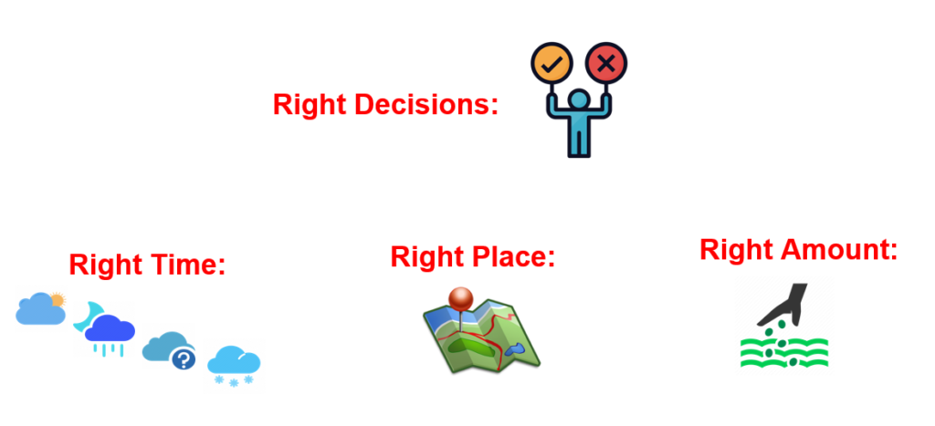
Farmers frequently need to make challenging decisions (right decisions, right time, right place, , and right amount) that impact crop productivity, profitability, and sustainability. Making the right decision is often the difference between profit and loss. Farmers require hard numbers to allow them to rapidly make informed decisions. However, much of this information is collected through laborious manual observation, guesswork, or subjective data collection. For example, crop yield estimation can help producers, agronomists, breeders, researchers, insurance companies, policy makers, and governments to rapidly make informed management and financial decisions. Monitoring and estimating in-field crop yield in real-time is now required more frequently due to climate change. However, obtaining accurate yield estimates at the individual farm field level still rely on inaccurate, unpleasant, and time-consuming manual observation.
Timely and accurate crop yield estimation can increase a farmer’s gross revenue by 10-30%. Below are three business scenarios.
a. When planning a sale, grain companies contact railways as far ahead as three months to confirm that they will have the capacity to move the grain. It is not uncommon for wheat prices to be 10% higher (or more) outside the harvest window. Therefore, producers usually pre-sell a portion of the wheat crop prior (possibly in July) to the harvest to obtain a favorable price. Producers need to estimate the approximate crop yield in a wheat field before they can make an informed decision on how much to charge a prospective buyer. As the market price can drop any time, producers need to know the crop yield in their field within one day. However, rapidly estimating a crop yield is a challenge.
b. Fungicide application is costly, but under the right conditions, with the right timing, it can increase a crop yield by more than 30%. With SGA technology, a high-resolution growth stage map can be created for a wheat field and combined with a high-resolution estimated wheat yield map. This information tells producers where and when to apply fungicide, and to apply fungicide only to certain areas of a field, or to time application differently in separate areas of a field to increase chemical efficacy or decrease chemical use. Our technology could result in a 10% reduction in fungicide applied to Saskatchewan fields.
c. The Canadian government plans to reduce nitrous oxide (N2O) emissions from synthetic fertilizer by 30 per cent in 2030 relative to a 2020 baseline. A big crop requires more nutrients than a small crop. The crop yield is estimated accurately as possible so that appropriate fertilizer is provided. SGA technology can increase fertilizer efficacy and decrease fertilizer use.
2. Wheat Fusarium Management Challenge
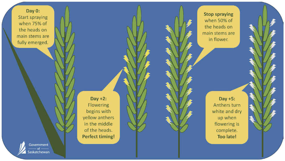
According to the Sask What guide, a real-time high-resolution FHB risk map, an estimated yield map and a growth stage map of the wheat in the field would be vital for FHB management. Current crop yield and staging assessments rely on manual observation in various locations around a field at almost daily intervals as the application window approaches. It is difficult to identify and predict the optimal timing for fungicide application in a consistent field let alone a field which has inconsistent growth stages. These manual, subjective tasks are time consuming, and are often not an accurate representation of the field as a whole. Common issues include (i) growers often miscalculating the true level of wheat growth stages, (ii) individual inspectors evaluating growth stages and crop yield differently. Furthermore, those manual tasks are unable to create the three maps in an uneven field rapidly and accurately.
3. The current ‘quick and easy’ practice of crop yield estimation
Methods: To estimate crop yield in a field, producers and agronomists randomly select and manually count the number of wheat heads from a specific length (e.g., 3 ft) of plant row in various spots around a field. By counting kernels on heads, determining the distance between rows, and applying each measure to a formula, yield can be approximated.
Problems: (1). Crop yield estimation relies on unpleasant and time-consuming manual observation. (2). Rapidly estimating crop yield is challenged due to the time it takes and the difficulty in selecting sufficient representative samples. The sustained manual work causes miscounts, and fields are seldom uniform; drought usually accentuates field yield variability.
4. Super GeoAI Smartphone Solution
Solution: Users walk with a smartphone to take several photos per representative location around a field. Our mobile application can count and label wheat heads, and calculate crop yield and stage in the photo within three seconds, with an accuracy approaching 100%. Once users take a certain number of photos, our app can give users approximately accurate crop yield estimation (such as bushels per acre) and growth stages in a field.
The smartphone photos will be first processed to calculate crop yield and growth stage by our fast GeoAI algorithms in the smartphone. The photos will be automatically uploaded and processed by our advanced GeoAI algorithms in our cloud platform, provided that the internet is available. If the advanced algorithms have better results, it will update the local result. In addition, users can login to the cloud platform to visualize the accuracy and easily fix any AI mistakes to achieve 100% accuracy, if necessary.
(1). The following demo uses our mobile app prototype to take photos of wheat heads (about two rows and 3 feet length per photo). The app immediately calculates the crop yield in each photo and the average crop yield in the whole field. Click Here to download the original high-resolution video. You can select the Settings Gear Icon on the lower right-hand side of the player and Select the Quality drop down box that pops up to change YouTube Video Quality Setting.
(2). The following demo uses the smartphone camera to take several photos per representative location around a field and uses our mobile app prototype to calculate crop yield in these photos at one time. Click Here to download the original high-resolution video. You can select the Settings Gear Icon on the lower right-hand side of the player and Select the Quality drop down box that pops up to change YouTube Video Quality Setting.
5. Super GeoAI Drone Solution
Solution 1: While our mobile application can achieve approaching 100% accuracy for each photo, producers may be unable to randomly adequate representative samples throughout an non-uniform crop field. Our GeoAI-driven drones have the ability to rapidly and randomly sample throughout a field, providing a higher level of assessment accuracy over walking and selecting spots manually in the field. Our GeoAI-driven drone can automatically take off from farmers’ backyard, fly to the crop fields and take photos. Upon task completion, the drone will automatically return to the starting location. The drone image (e.g., The file size of a DJI mini 2 drone image that covers 30sq ft is about 5 MB.) will be automatically uploaded and processed to calculate crop yield and growth stage by our GeoAI algorithms in our cloud platform, given that the internet and Wi-Fi is available. Users can also manually upload drone images into our cloud platform.
Users can upload drone images in our cloud platform to calculate the wheat crop yield in the images. Below is a demo video. Click on the three-dot icon at the lower right-hand side of the player to download the original high-resolution video. You can also play the reduced resolution video faster Here at YouTube.
Solution 2: Random sampling throughout a field provides higher assessment accuracy than walking and selecting spots in the field manually. However, fields are seldom uniform and drought usually accentuates field yield variability. Integrating the traditional vegetation indices and traditional crop yield prediction model into our GeoAI-driven models can create high-resolution estimated yield maps and growth stage maps of a field. We are developing our advanced GeoAI models for this solution.
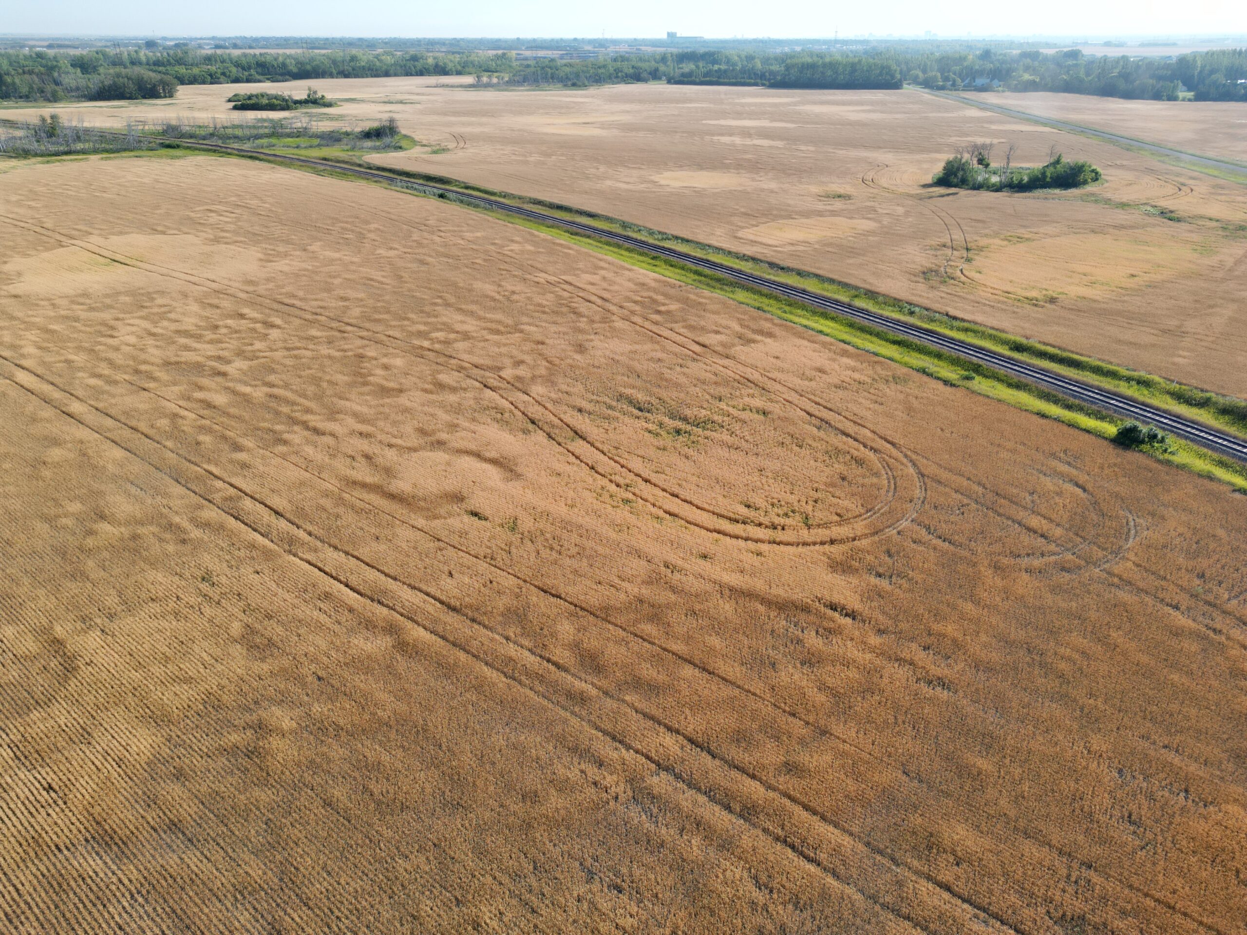
The following drone image shows the variability of crop throughout a field, where some areas have a much higher wheat yield than others.
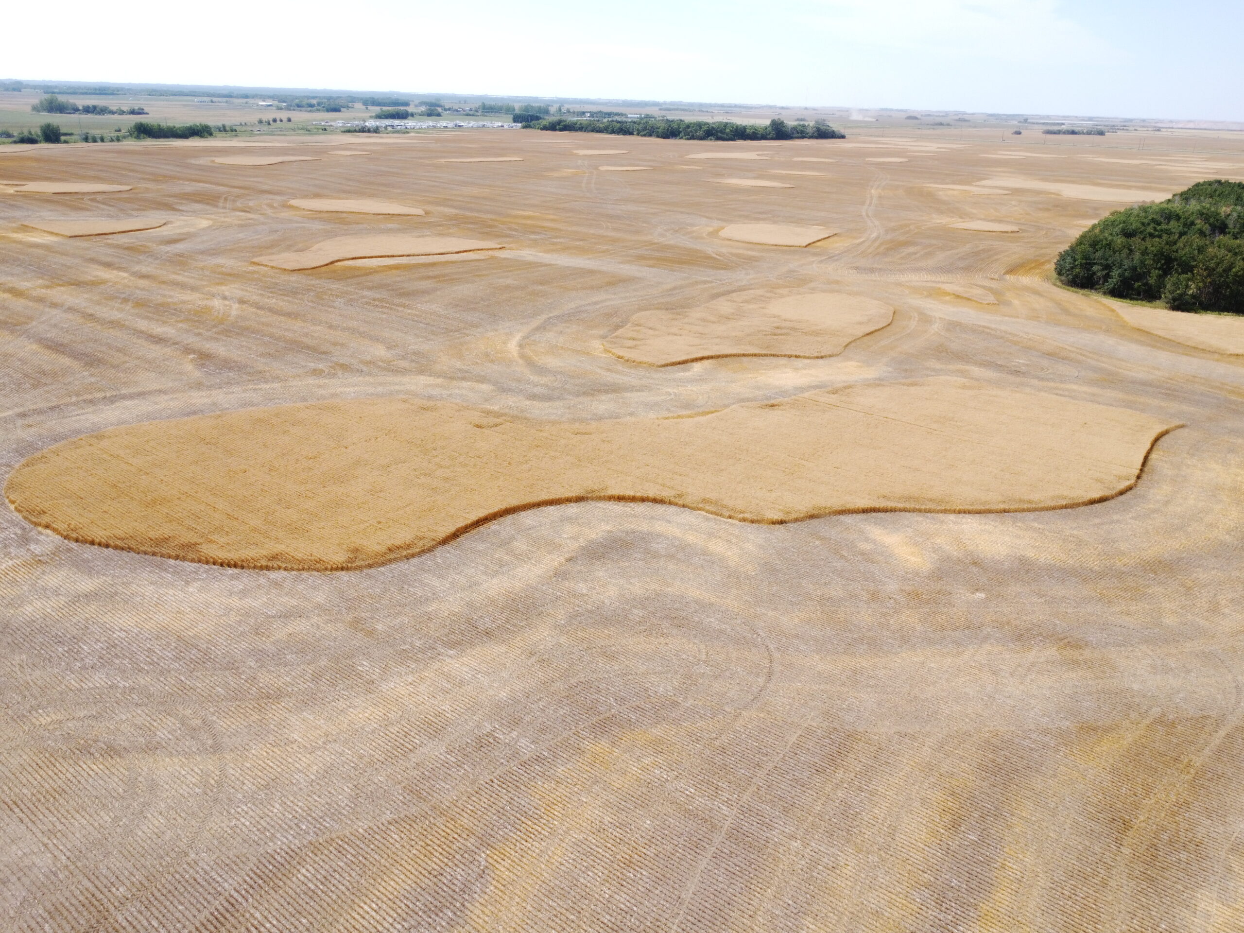
The following drone image shows the SGA’s own non-uniform wheat field in 2022. The areas with higher yield and later maturity have not yet been harvested. A drone can take photos of the areas about 30-100 meters above ground and our GeoAI algorithms can accurately calculate these polygon areas.
The following video shows that the Dji Mini 2 drone is collecting wheat head data about 2-3 meters above ground. Click on the three-dot icon on the lower right-hand side of the player to download the original high-resolution video and play. You can also play the reduced resolution video faster Here at YouTube.
The following video (472 mb) shows the Dji Mini 2 collecting wheat data from 50 meters to 3 meters above the ground. Click Here to download the original high-resolution video. You can select the Settings Gear Icon on the lower right-hand side of the player and Select the Quality drop down box that pops up to change YouTube Video Quality Setting.
We were harvesting wheat at Super GeoAI R&D Farm Field on August 18, 2022. The brighter areas with higher yield and later maturity were harvested later.
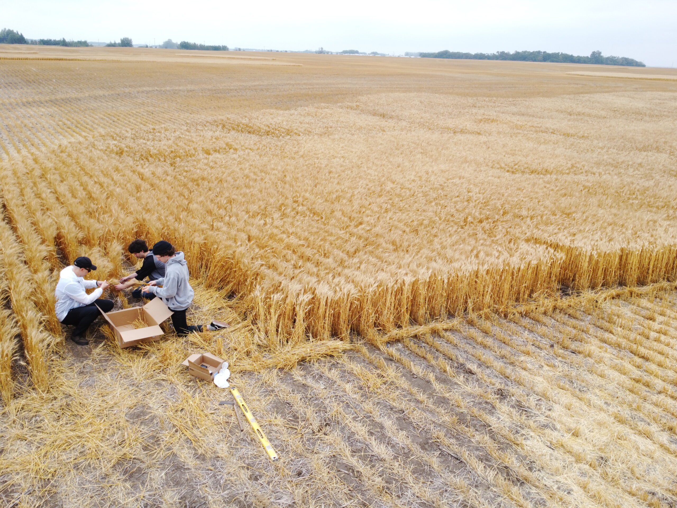
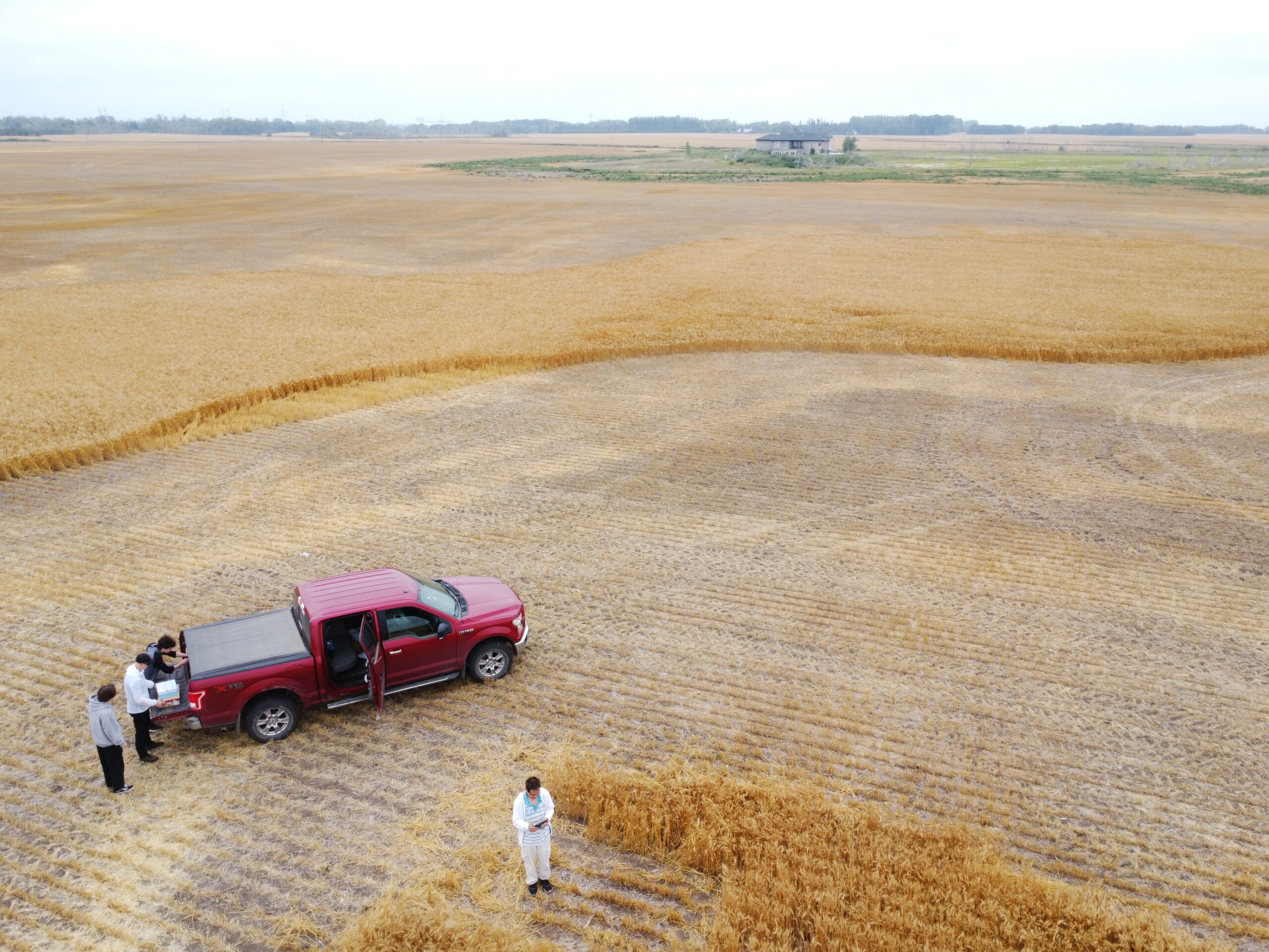
6. Super GeoAI Crop Yield Prototype Testing and Validation
In the following drone video and drone photos shows that SGA development team is testing and validating SGA’s crop yield prototypes in SGA’s wheat field in August 2022.