
INNOVATIVE AI-DRIVEN SOLUTION
We research and develop innovative, customized AI-driven solutions specifically tailored to your project needs.
Super GeoAI Technology Inc. (SGA) is an innovative AI-based research and development company. At the heart of SGA’s mission is the development of cutting-edge software applications, services, and solutions leveraging Geospatial Artificial Intelligence (GeoAI) and Generative AI (GenAI) technologies. These advancements are designed to automate a wide range of labor-intensive tasks across sectors such as agriculture, urban planning, 3D Lidar Snow Volume Measurement, and more, enabling rapid and informed decision-making.
Why Us
The leading multidisciplinary AI team in Western Canada, integrating innovations in Geospatial Artificial Intelligence (GeoAI), Generative AI (GenAI), big data, mobile apps, unmanned aerial vehicles (UAV), and cloud computing to tackle challenging problems.
- FEASIBILITY: Identify requirements and develop a tailored plan for your business.
- CUSTOM ANALYSIS: Work with our geospatial AI experts to ensure data-driven results.
- INTEGRATION: Understand how to improve your business with Geospatial, AI and drone technologie.
What You Get
Whatever the scope of your work, SGA experts can meet your needs. We strive to meet our customer’s need by providing great technology and unmatched services delivered within a flexible and cost-effective business model.
- Innovative AI-driven Solutions: provides comprehensive industry, domain, and technical expertise to address real world problems.
- Quality Unsurpassed: Our Focus Is 100% On Client Needs And Satisfaction.
- Cost-Effective: We are dedicated, creative, focused, and able to deliver high-quality work on time within the budget.
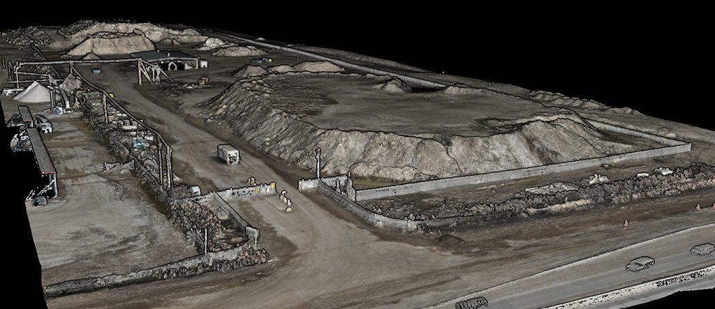
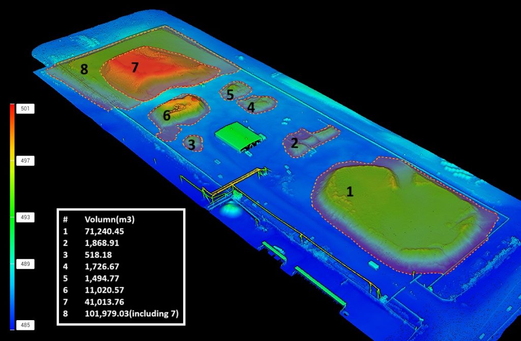
LiDAR and Aerial Imagery Acquisition and Analysis
Aerial Imagery Acquisition
“Coming together is a beginning; keeping together is progress; working together is success.” – Henry Ford
STAY IN THE LOOP
subscribe to SGA’s monthly newsletter