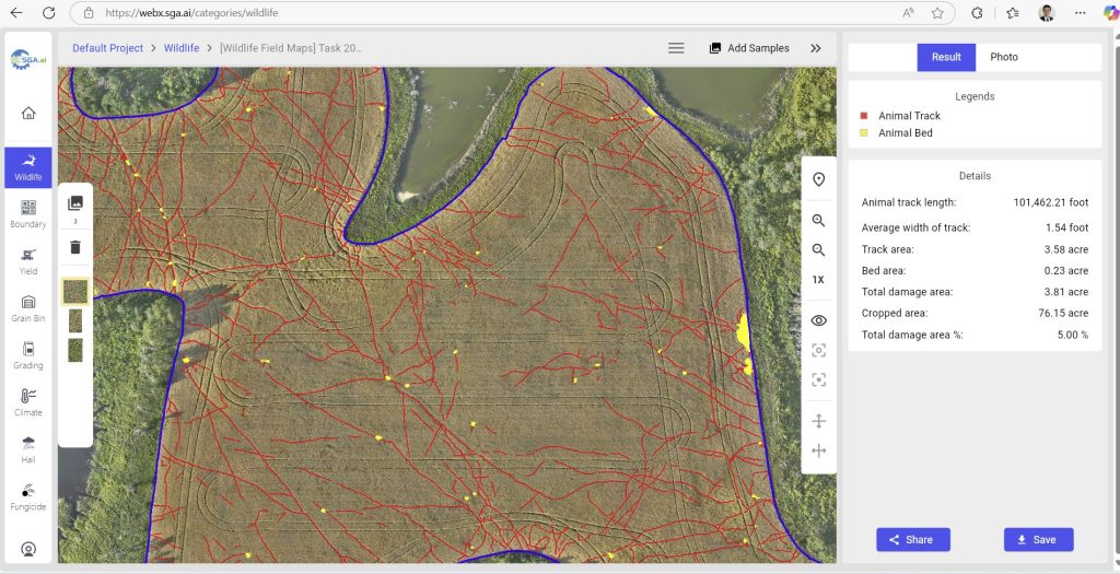
Video 1: This video demonstrates how users can effortlessly upload drone images to the SGA cloud platform to accurately calculate wildlife damage areas. The platform measures animal track lengths and widths, animal beds, and the damaged polygon areas in the fields. Our advanced GeoAI algorithms also distinguish between wildlife and vehicle tracks. For the best viewing experience, please select ‘Quality’ and ‘Auto (720p)’ in the bottom right of your YouTube video settings.
Video 2: demonstrates how the SGA GeoAI Platform is used for wildlife damage assessment by using a stitched drone image of a field.
Video 3: This video showcases how users can efficiently utilize the SGA Cloud Platform to review, delete, add, edit, and correct AI-identified wildlife-damaged areas, as well as assign a loss percentage to the regrowth in green zones.
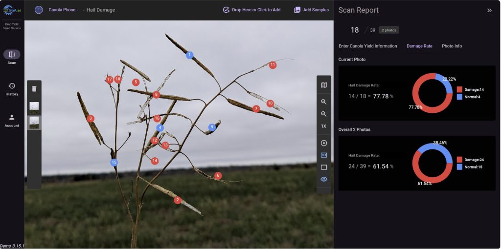
GeoAI-Driven Solution for Hail Damage Assessment
Our AI-driven cloud and mobile applications can automatically quantify and evaluate the percentage of hail damage in images captured by phones or drones.